Central Valley, California:
Aquifer management (cont'd)
DYNPLOT was also used in this project to display model results such as head contours and spatial data such as pumping distributions in the area.
Regional Groundwater Table
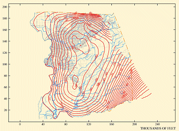
(Click image for larger view)
Spatial Distribution of Groundwater Pumping
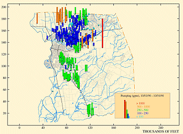
(Click image for larger view)


