Fuel Terminal Site, Nevada:
Simulation of Contaminant Capture
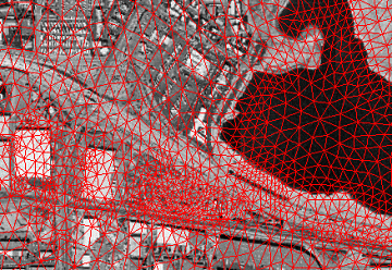
A groundwater model was built to simulate benzene and MTBE plumes migrating from a fuel terminal and rail yard in Nevada. The model included remediation pumping simulation and 3-dimensional capture zone analysis. The model has seen continued use in order to fine-tune the containment system design. The finite-element grid is shown below as viewed in Arcview GIS along with an aerial photo.
Notice how the grid flexibility is used to concentrate nodes around pumping wells on the left of the picture and to conform to the water body on the right of the picture.
Fuel Terminal Model Grid
(Click image for larger view)


