Long Island, New York:
Regional groundwater management planning (cont'd)
The complex grid of the local Great Neck model is shown in the following pictures. DYNPLOT has many grid-building features like the ability to create a local model from a larger model grid. The cross-section image shows how complex the stratigraphy of the local model is and how aquifer heads are affected in the area.
Local Model of Great Neck
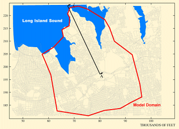
(Click image for larger view)
Great Neck Model Cross-Section
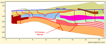
(Click image for larger view)


